Thursday, February 20, 2020

Tanzania: The Things I Learned (What To Do If You Want To Partake in This Insanity)

One last post on Kilimanjaro.  I'll call this my lessons learned.  Or maybe things I wish I had known before hand.  Or maybe things I would have done differently.  Good things to know.  All the information!


Things That Worked Out Well

  • Everything related to using Peak Planet as our guide company went well.  The people were great.  The rented gear was great.  The food was great.  Seriously...if you go, look to them first!
  • Preparation:
    • If you can't go hiking on a regular basis due to location, stairs are good.  And I mean stairs, not a StairMaster.  When you do stairs you have to go both up and down which works all the muscles in the legs, not just the ones for going up, because remember...you have to come down too.
    • I was glad I hadn't just worked my legs, but also my core and arms.  Remember, you will be carrying a 10-15 lb pack on your back, so be prepared for it.  Also, on the way down, I was putting a lot of weight on my trekking poles to keep the weight off my knees.  In doing so, I was using my tricep muscles a lot.
  • Compeed.  These were a lifesaver for me.  My feet tend to blister easily, even if my shoes are broken in and I'm wearing a good pair of socks.  Ask my family, they can tell you.  My friend Amy told me about Compeed and I put some on my most blister-prone areas the morning we left and they worked like a charm.  I never had an issue.  The Compeed patches stayed on 3-4 days.  I used one on each heel, for a total of 4 on the trip.  I would never go on a trip without Compeed again.


Things That Could Have Gone Better
  • Weather...but we don't have control over that.  We booked for the dry season, but it still rained.  They said it was unusual this time of year.
  • Battery Pack - I had bought a battery pack/solar charger to use.  It worked great until one day I went to turn it on and it was completely dead.  I'm not sure what happened.  I don't know if the flashlight on it had gotten turned on in my duffel, draining it or what.  After it was drained, it wouldn't charge by solar panel.  I don't know if it is an issue with the pack, or that's how it was.  I haven't tried charging it up that way since.  But if you plan to use your phone as a camera, make sure to have a battery source to charge it.


Packing:
      Things I Would Have Left Behind:
  • Snacks - I brought way too many.  I would say bring one snack per day and maybe two for summit day, and you'll be fine. 
  • Toilet Paper - They said to bring a whole roll of toilet paper to keep in your daypack.  I never used it.  If you're the sort of person who is fine with not wiping, they maybe bring a partial roll in case you need it for cases of pooping on the side of the trail.  A full roll just took up space in my pack.
  • Pee Bottle - If you're the sort of person who would rather not get up in the middle of the night and go out to the toilet tent then maybe you want a pee bottle.  I found it another item that was a waste of space.
  • She-wee - I used it the first time, but just decided that it was easier to squat to pee.  
  • Camp Shoes - I'm still on the fence with this one.  I probably would have worn them more if they hadn't gotten wet on Day 2.  But at the same time, I ended up wearing my hiking boots in camp and that was fine.  Maybe things wound have been different if it wasn't wet at the time.  We might have spent more time outside wandering a little, in which case, maybe they would have been nice.

      Things I'm Glad I Had:
  • Propel Packets - I had 2 Nalgene bottles with me to go along with my 3L hydration pack.  I kept one Nalgene bottle filled with water and the other had Propel mixed in.  Any time we stopped for a break I drank from the Propel bottle.  Any walking and drinking, I used the hydration pack or other Nalgene bottle.
  • Compeed - See above
  • Sun Hat - I had a sun hat with a wide brim the entire way around.  When we did have sun, it was great for keeping the sun out of my face.  But more often it was used to keep the rain out of my face.  I never once had an issue with my glasses getting wet thanks to the solidness of the brim of my hat.
  • Extra Shoelaces - I didn't use them for my shoes, but instead strung one up in our tent to let items dry out.  Socks, shirts, pants.  These items were soaked when I hung them, but damp and by morning they were dry.
  • Packing Cubes -  They kept things organized.  I reorganized a couple times on the trip as items got worn.  For me they just made life easier.
  • Rain Coat - It rained a lot, so I was happy I had a good rain coat.
  • Rain Cover - Along with the rain coat, I was glad to have a rain cover for my daypack, which kept it dry when it rained.
  • Journal - I glad I brought a journal so I could write everything down...which I then shared with you. :)


If you have any questions, I'll be glad to answer.  I feel like there are things on here I forgot, but oh well.


Wednesday, February 19, 2020

Tanzania: One Last Time

Well, what goes up, must come down.  We set out from Moshi on January 26th and set to return back to Moshi and the Stella Maris Lodge on February 2nd.

I woke up well rested on our last morning of the trek.  It would be the last time sleeping in the tent and in the sleeping bag...and thank goodness!  It was starting to really smell in there.  Turns out a week hiking, with no showers, wearing the same clothes, and dealing with rain leads to some smelly people.  It was our last meal in camp together. :(


After breakfast the entire group gathered together.  All 9 of us clients, our guides, and all the staff who helped us that week.  We had some last words and basically told them all how awesome they were because knew there was no way we would have gotten anywhere near the summit, let alone to the top, without them.  We announced what tips everyone would be receiving.  This way they would have an idea of what sort of income to expect, and they knew they wouldn't be cheated by anyone.  I hadn't mentioned it thus far, but we actually had 2 female porters in our team.  Nearly all of the porters you see on the mountain are men.  Being a female porter is a big deal.  So way to go ladies for being awesome!

On the way up to the summit we followed the Lemosho trail, but on the way down it was the Mweka route we followed.  The Mweka route is used almost exclusively for going down the mountain, or for porters taking up fresh food supplies to the Karanga and Barafu camps.  It was obviously a lot of downhill.  I took a large dose of ibuprofen to keep my knees from wanting to kill me and down we went.


The first part was rocky and not a ton of fun.  Joseph, I believe it was, said that during the rainy season, that part of the trail becomes a stream.  It stayed that way from the Millennium Camp down to the Mweka Camp.  Had we had any remaining energy left the night before, we could have continued down to the Mweka Camp and slept in on the last morning.  No thank you!  Barely made it to the Millennium Camp.

We had some last Swahili lessons on the downhill trek between the two camps from Simon.  We had some last views of Kilimanjaro.  We had some last pee breaks on the side of the trail in the bushes.  We had some last songs...namely the one about missing our beds and our showers.


After we hit the Mweka Camp, the trail moved back into rainforests and more of a semi-muddy sort of trail.  The rain then started and it really got muddy.  Not a hard rain, but just one that was enough to make the trails more muddy.


We eventually hit the end of the trail trail, and the last maybe half to one mile of trail was on an emergency road.  Every time we came around a bend we thought, we must be almost there!  But then there was more road.  Finally we could see a sign that said "Congratulations! Bon Voyage!"  We had made it!!!  We were exhausted, but we had made it.  We signed out at the gate and got certificates saying we had successfully summitted Kilimanjaro (Alex unfortunately didn't get one).  We celebrated with beer, Cokes, and Joseph with his Sprite.


We then boarded the bus and head to a small center just a few miles away.  We had our last lunch provided by Peak Planet and got to wander through the gift shop.  Then it was back on the bus to the lodge where we got a joyous welcome back!  They had juice for us and led us to our rooms.  We met up real quickly to say final goodbyes to our guides and turn in any gear we had rented (sleeping bags in mine and Alex's case).  Then the showers were calling to us!  Nothing had every felt me glorious than that shower.  Except it couldn't be as hot as I had wished because my face was horribly sunburned from the day before.  But still, a shower felt wonderful.

The group had planned to meet up for one last meal together that evening.  We went into Moshi to a restaurant that was an odd mix of Indian and Italian food.  It was exactly what we needed.  And amazingly cheap ($120 for 10 people!!).  Emmanuel even met us there.  He was heading out the next day for another trip up the mountain!  Everyone said their goodbyes that night.  Alex, Jay, and I were heading back home the following day, but the rest were heading out on safari.


The following day I slept until waking up, which was nice.  It was a Monday so you could hear the school children at the Stella Maris School doing their lessons.  We took it easy and packed.  In the evening we headed for the airport.

Our flight left Arusha at 9:35 pm, with a quick stop over in Dar Es Salam (we didn't get off), before heading to Amsterdam.  I resigned myself to the fact I wasn't going to sleep most likely, so just watched a bunch of movies.  We had a layover in Amsterdam, before heading to Detroit.  Because the Covid-19 coronavirus ordeal had exploded while we were on the mountain, we were questioned before boarding the plane about if we had recently been to China.  They even checked our passports for visas from China.

In Detroit we made it through customs.  Alex learned that if you tell a customs agent that you had come from Tahn-zahn-yah, he will look at you blankly before he realizes you are saying Tan-zu-ni-yah.  For your info, Tahn-zahn-yah is the correct pronunciation per our guides, so I'll trust that they are correct.  Our flight from Detroit to Chicago was late and the two of us nearly fell asleep at the gate.  In Chicago, after getting some food, I found an out of the way place at my gate and slept on the floor for over an hour.  By the time I got home, I had been in transit for over 36 hours.  I was exhausted!  Thank goodness I didn't have to go into work the next day.

Despite Alex not making it up Kilimanjaro, I'd say it was a successful trip.  We had a great time and made a bunch of new friends from around the country and in Tanzania.

Can you believe I climbed that mountain?!?!

Tuesday, February 18, 2020

Tanzania: Standing on Top of Mount Kilimanjaro, Watching the Sunrise, the Wind in My Hair

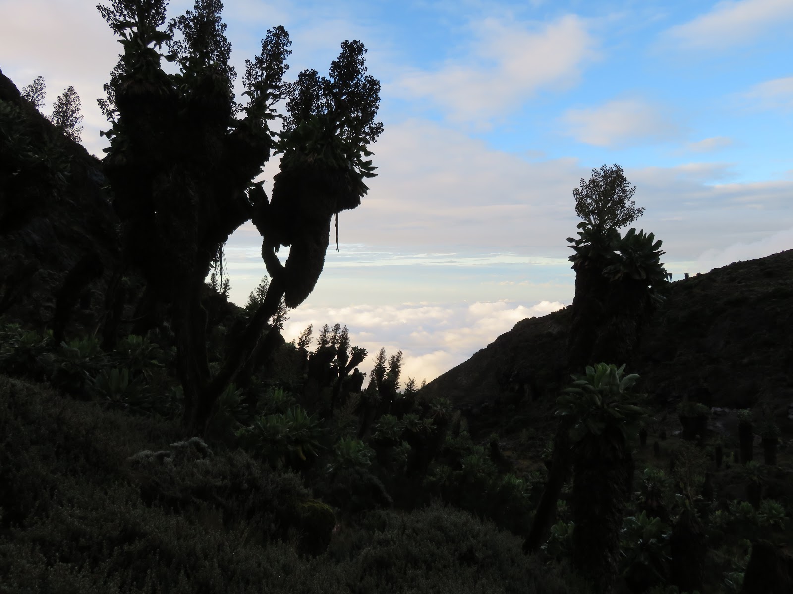
Caspar took this photo of the sunrise...I was too busy trying to breathe.

I'm not sure if anyone else remembers the animated Pippi Longstocking movie from the 90s (maybe it's just me because I finally found someone with hair that looked like mine), but the opening song from the film factors into summit day.  The song is called "What Shall I Do Today" and the opening lines are "Standing on top of Mount Kilimanjaro/Watching the Sunrise, the wind in my hair/I'm gonna go wherever I wanna go/there's magic everywhere..."  I literally sang that opening verse dozens of times on Summit Day.

Summitting Mount Kilimanjaro is without doubt, the hardest thing I have done mentally and physically in my entire life.  It took everything I had to make it up that mountain.  Maybe in different weather conditions it would be a different story, but in the midst of sleet and snow, it was ridiculously tough.

I woke up from a light doze to the sound of rain pelting the tent.  I said to myself, "I hope it isn't almost 11, because I don't want to hike in this crap."  I looked at my watch...10:55 pm.  Shoot!  A few minutes later, there was a knocking on our tent saying it was time to wake up.  I put on my first longsleeve base layer, followed by my fleece base layer, followed by inner jacket, and lastly my outer jacket on top.  On the bottom it was light base layer pants, fleece base layer pants, hiking pants, with rain pants on the outside.  I had a balaclava tucked into my layers on top and pulled over my head, with my warm ISU beanie on top.  I had my warm ski gloves on my hands...once we got going.

We had a light breakfast.  I certainly wasn't hungry and neither were most people.  We were complaining about the rain and Caspar said it would turn to snow before we left for the summit.  We were told it almost never rains up at Barafu Camp, but there we were, at nearly midnight and it was raining.  They told us what order we'd be hiking in.  I was given number 6 and Alex would be bringing up the rear at 9.  Just as we were getting ready to set out the rain turned to a wet snow.  Guess Caspar was right.

One of our superporters took this photo of us trekking along behind Caspar.

Besides our four guides Caspar, Simon, Joseph, and Emmanuel, we also had 6 additional porters with us to help us out.  Essentially one per person.  The goal was to stay together, but if necessary, one would stay with us to help us out.  We would not have made it up the mountain without them.

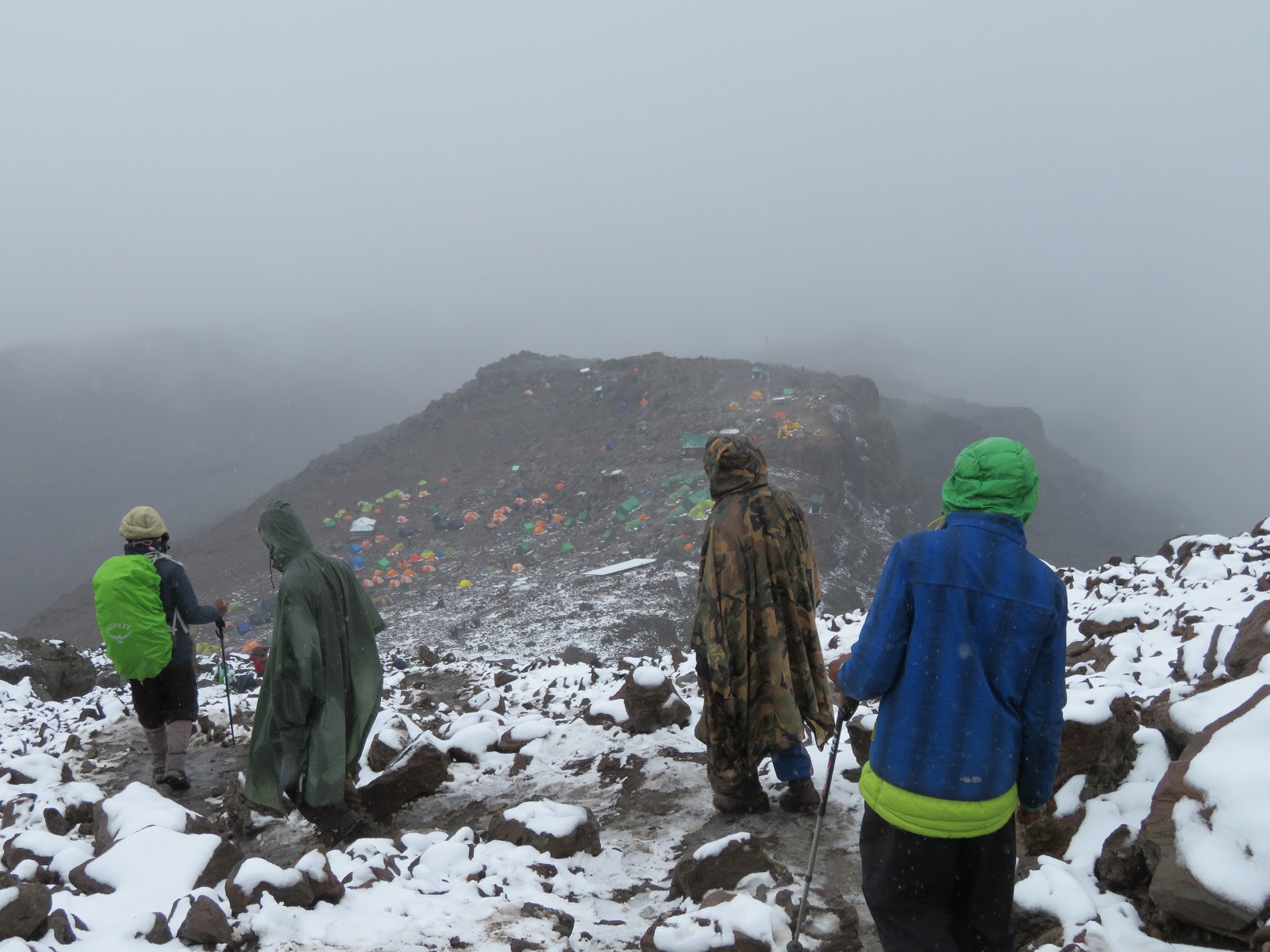
As we set out, headlamps on, we passed other camps and could see lights in some tents as their people were getting ready to set out as well.  We slowly pushed up the mountain.  It is hard to say what was out there because it was snowing and dark so we couldn't see far.  After a little bit we reach a rocky area that we were to climb.  The snow was slick on the rocks and our superporters helped us out by giving us a hand.  In less snowy times, I think the path would have been a grueling series of switchbacks and some small scrambles, but the snow made it almost as if for every two steps forward you took, you went one back, because your feet were slipping under you.


To start with we took a few minute break every 20-30 minutes.  The higher on the mountain we got, the further apart the breaks got.  There were so many people on the mountain making their way up.  If you looked up you could see the glow of headlamps up above.  I figured the furthest group up that I could see was probably at least 50 vertical meters up from us.  If you looked down you could see the lights of people who started after us.  Occasionally we would stop and let someone pass us, or we would pass another group.  We were one of the larger groups that I saw.  When we were talking afterwards, some of the group said they had to stop looking up because it was disheartening to see the lights still going up.  For me it was a goal..."I can make it up to where they are."

Four hours in I had to give up my daypack.  Caspar looked at me during a break and asked how I was feeling.  I said my legs were tired and he told one of the superporters to take my daypack.  This took about 10 lbs off my back which instantly helped, but it did mean my access to my water was somewhat restricted the rest of the way.  I could only get to it when we stopped for a break.  At one point when we were on a break, one of the guides opened up what was literally a bag of sugar and told us to open our mouths.  He poured sugar in and for about 5 minutes it totally helped.  And then it had run its course.

Partway up the mountain, Jay, aka Baba Simba, started using the portable oxygen that he had paid for to help him out on the climb to the summit.  The rest of us just pushed on with what we could get from the air.  At the top of Kilimanjaro there is approximately 52% less oxygen than at sea level.  It was probably in the 17,000 foot range that I started to really notice the altitude kicking in.  A headache began and by the time we reached the top I was nauseous, but not quite feeling like I was going to throw up, but just like I could.


The sky eventually started to lighten.  We were probably about 100-200 vertical meters below Stella Point (the point at the crater rim that we were aiming for before heading to the peak) when sunrise hit.  We stopped and watched, and it had to be one of the most beautiful sunrises I've ever seen.  Kansas can have some pretty ones, but this was something else entirely.  After the sun was up, we made our final push for the top.

Making our way from Stella Point to Uhuru Peak.
Caspar, Ashely, Me, Tim, Bre, Mimi, Ben
Making it up to Stella Point was huge.  I felt that if I made it up there, I could definitely make it to the top.  We stopped for a brief tea and snack break before heading off for Uhuru Peak, the summit.  The snow up top was probably a meter deep; more in some places, less in others.  It took probably somewhere around 45 minutes to make the trek from Stella Point to Uhuru Peak.  You could see down into the volcanic crater one way, and to some glaciers the other way.


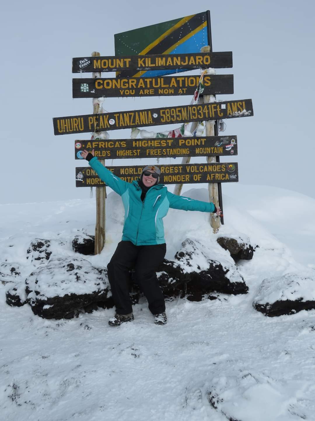
Finally, the sign for Uhuru Peak was ahead.  We made it!  19,341 feet!  We took a bunch of photos.  Individual photos and some group photos. Of our group, Sunny was a bit further behind so missed the group photo and Alex had to turn back hours earlier due to issues with the altitude.  We stayed up at Uhuru Peak for maybe 10-15 minutes.  Really just long enough for everyone to take photos and get one last look around and then we turned back to Stella Point.  We took one last, quick break at Stella Point (I peed at the top of Mount Kilimanjaro! 18,885 ft!), and then down we went.


Down was the part I was dreading.  I can go up any day.  I might get slower and slower, but I will keep going.  Down is scary and hard on my knees.  And the way they want you to go down, as quickly as possible is even scarier.  I get why they wanted us to get down.  We had already been hiking for probably 10 hours and the quicker you can get to a lower elevation, the better off you'll feel.  They showed us the key to get down a snowy mountain quickly and it involved almost slip skiing down the mountain.  Hit a patch of snow at an angle and you can get down probably 8-10 feet in a slip.  But you have to be careful.  At one point and we were getting lower, I slipped and hit the back of my head on the ground, which totally didn't feel good.  I didn't go unconscious at all, but the headache I was dealing with suddenly doubled in pain.  Thankfully we stopped about 10 minutes later and Bre had some good pain reliever on hand to give me.


Some of our porters who had stayed behind had come out to meet us with juice and that was extremely welcome.  They helped guide our exhausted selves back to camp, which was still probably an hour more at least.  And to make matter more fun, after dealing with warm sun that had us stripping layers off on the side of the mountain, the rain reappeared.

Exhausted and tired beyond reason, we stumbled into camp where we were to change quickly and then eat lunch.  Due to the nausea I had been feeling since near the top, I totally wasn't into food.  I ate a little because I knew I needed too, but I couldn't stomach much.  After lunch we set off again...because climbing and descending 4500 vertical feet isn't enough, we also had to continue down to the Millennium Camp, which was an additional 2000 feet down.  At least this part wasn't as steep as coming down from Lava Tower was, or coming down from the summit.  It was just a continuous downward slope.

The thing that kept me going, was I knew down at camp was my tent and sleeping bag, and dry shoes.  I was beyond exhausted and camp just wouldn't get any closer.  Because it was below us, we could see it a lot sooner and it didn't look that far away...but it totally was.  The guides were good at fooling you.  "Yeah, we're almost there."  "If we take just a short break, we could be there in 30 minutes." ...One Hour Later...


When we stumbled into camp, Alex was there waiting for us.  He told us he had reached a point probably around 16,500 where his body just lost all energy and he couldn't go.  Simon told him he could keep trying, but it would probably be best if he turned around and went back to camp.  So Alex and Simon went back down to the Barafu Camp where he napped for a couple hours.  They then packed up our tent and the two of them, along with a few porters, made their way to Millennium Camp.  Alex said he napped some more there as well.

That evening, for supper, Peter the cook made a cake!  It was delicious, and about the only thing I wanted to eat.  I tried the rice and the potatoes, but couldn't eat any of it.  But I got a good slice of cake down.

When I went to bed that night, I slept like a rock.  Alex said that it was obvious that I was dead asleep the few times he got up to go to the bathroom.  Day 7 was the longest and most thrilling day of my life!  And I have a certificate and photos to prove it!

Monday, February 17, 2020

Tanzania: One Last Steep Incline for Good Measure

It was sunny before we left Karanga.
Day 6 was short, so this will be short.  The plan for the day was a whole 4 km, and it was going to take us a whole 4 hours to do it.  That might give you an idea of how tough of a day it was.  This was our last day of hiking before Summit Day, so we had a lot of elevation to cover.  We started out at 13,300 feet at the Karanga Camp and would be ending up at 15,250 at the Barafu Camp.  So we had about 2,000 feet to cover in 4km (aka 2.5 miles).  Before we left camp we had our final pre-summit med checks.  Everyone checked out so we were all allowed to make a run for the summit.


My journal entry for the days literally reads as follows:

It started out with a steep incline, then moved to a steep descent, followed by one last steep incline for good measure.

Just after arriving at camp the rain appeared...again.  We had lunch and then were sent off to bed at 1 in the afternoon.  Supper would be at 6.  Then we were to head back to bed from 7 to 11 before being woken up for Summit Day.  Sleep was vital...which means I got very little.

And that was Day 6.

Sunny, Alex, and Ben


Sunday, February 16, 2020

Tanzania: A Sky Full of Stars


How would you like to tackle an 800 foot wall right after breakfast?  If that is something that sounds fun, Day 5 on the Lemosho Route is for you!  We got up early so we could get to the Barranco Wall before things got to busy.  I guess if you wait until a little bit later, you start to get a line of groups waiting to go up.  We were early enough there was no hold up.  But before we got to the Barranco Wall, we got to cross not one, not two, but three small rivers.  After crossing the rivers we had one last brief rest/bathroom break before tackling the wall.  We handed over all our trekking poles to our guides because the Barranco Wall requires hands and feet to get up.  This is really the most technical the climb gets.

You can see the trail in the upper right hand corner.  These are the three rivers we had to cross to get to the Barranco Wall.

Climbing the Barranco Wall involves a lot of not looking down, because it is a long way down.  Ledges aren't super wide, but you also don't feel you're one misstep from falling off the edge...more like two missteps.  Our guides very carefully showed us where to put hands and feet to get up safely.  There is one place called the Kissing Rock where you basically hug a rock as you go around, and that was probably one of the most nerve-wracking places of the climb.  Overall, it actually wasn't as bad as I feared.  I am glad, though, that we didn't have to do it in rain.  Now that would have been frightening.  It was actually a very beautiful morning.  

Simon helping Mimi, with Caspar on the left climbing up.  Alex and Tim in the back.

I don't think I was fully prepared for the view from the top.  It was stunning.  Looking one way, the mountain was right there.  For the first time, it really seemed close enough to touch.  And looking the other way...well it looked like we were floating in the clouds.


We were on our way to the Karanga Camp which was actually fairly close in elevation to the Barranco Camp where we had spent the previous night, but in order to get there, we had to climb the Wall, and then do a series of ups and downs.  


We went through some interesting landscapes.  At one point we traveled through what was like an empty desert where all you could see was a series of small carved out gullies where water would likely run during the rainy season (which despite the fact we had had rain almost every day, was not this time period).  We crossed over the Karanga River, which was clear and fast, and also the last source of water on the route.  Porters carried water from the Karanga River, up to the camp that night, and then more water was carried on to the Barafu Camp the following night because there was no other water source up there.


We made good time and got to camp before noon.  We did an acclimatizing hike up an additional 100m vertical (300ish feet).  That seemed long and far.  As we did this, fog was constantly shifting in and out.  Sometimes you could see our camp, clear as day, and other times it had completely disappeared.  After returning to camp, we got lunch and then nap time.

After about 2 1/2 hours of napping, people started to give up and meet up outside because it was ACTUALLY NICE OUT!!!  By this point we were high enough on the mountain that it was rather chilly out, especially when you weren't moving.  In camp I was wearing my fleece base layers, with hiking pants and an additional fleece jacket, and eventually coat on top.  For the hike on this day, I had a base layer, long sleeve shirt, and fleece jacket for the first part of the day before eventually ditching the fleece.  

After the sun set, from camp we could see down to the lights of Moshi and Arusha.  It was stunning.  And the stars!!!  So beautiful.  I found Orion and Canus Major easily.  I also found Leo the Lion.  But I don't know what else was out there because I don't know my southern constellations.  I sat out on a rock in the dark for probably 15 minutes just taking it all in.  I wish we had more nights like this on the mountain.  I'm glad we got one, but a few more would have been lovely.

The lights of Moshi and Arusha down below us.
Orion above, with Canis Major below on the right.  The brightest start you see in Orion is Rigel, the 7th brightest star in the night sky. The bright star you see below and to the right of Rigel is Sirius, the brightest star in the night sky.  The other bright star you see in the lower left is Procyon, the 8th brightest star in the night sky.

Saturday, February 15, 2020

Tanzania: You Want Me To Climb Down That?!?

I think so far we can say that each day got progressively harder, so let's continue that trend.  Day 4 started out with a climb and maxed out in the middle with a trip up to Lava Tower, the highest point on the trail until you're actually summitting the mountain.  Day 4 was also the first day that you could really tell that Kilimanjaro is a volcano (or three) because this was when we started walking through some old lava fields.  Research says that the last time the main peak/volcano erupted was sometime around 150,000 to 200,000 years ago, but due to the fact that gases still sometimes steam out of the crater, it is not considered extinct, just dormant. 


We got up earlier on Day 4 than we had any day up to that point.  It was still somewhat dark when we left camp and many of us used our headlamps for the first 20 minutes or so until things brightened up.  And up was the name of the game today.  When we left Moir Camp, we left for up.  Up, up, and up.  Africans seems to only slightly believe in switchbacks, and their switchbacks are mostly up and less side to side.  It was after we scaled our first hill of the day that we got a little bit of a break by meandering through some lava fields.  We also got some great views of Kilimanjaro for one of the first times on the trip.  The whole thing for once!  Looking up at it from where we were, it still seemed like a really long way to go.  Was I really going to climb that?


We met back up with the people on the Lemosho Route who had spent the night at Shira 2, as well as those coming from the Machame Route.  The Machame Route was the first time we met up with another trail, but by the time we reached the Barafu Camp the night before summitting, we had met up with all, but one trail.


Lava Tower was the plan for the day.  Lava Tower stands at 15,190 feet tall, but the highest we would reach was 15,090 feet, because we were scaling Lava Tower, just going up to the plateau next to it.  The rise from our camp at Moir at 13k to 15k was really noticeable.  It definitely got a lot harder and when I got to the top, I had a bit of a headache.  I think everyone really felt a bit worse than they looked in photos.

Getting to the top of Lava Tower seemed like the hard part, but that was because we didn't know how it was coming down!  We were literally walking through a creek, that was a very steep drop.  It was frightening.  I'm not great with down because my knees don't really like doing it.  I was glad for once to actually be in the front because that meant I was able to watch where our guide Simon put his feet and he would help me down the really steep areas which was great.  By the time we got down the steepest part of the way down Lava Tower, my right knee was screaming at me.  I decided to wear my knee brace for the remainder of the trip.

Simon helping Mimi down.  As you can see, it was very steep and very rocky.


After leaving Lava Tower we still had a couple hours hike to our camp at Barranco for the night so we kept pushing.  Unfortunately we couldn't push enough to stay out of the rain.  It ended up being the wettest day so far.  My pants got soaked through and I probably should have put my rain pants on, but I didn't.  Oh well...hiking pants dry pretty quickly. 

What I call a "Pinapple Tree". 

There was still quite a bit of down and we got to pass through an area with some really unusual trees.  I don't remember what type of tree they are, but I call them pineapple trees because it kind of looks like a few really large pineapple are hanging from them (like, really, really large pineapple).  We were slow enough on the way down that some of our porters came back, met us, and took our daypacks from us so we didn't have to carry them.  It is amazing how much taking 15 pounds off your back helps.  

As usual, when we got to camp, everything was all set up.  The good news was that the camp was already set up before the rain arrived, so things stayed fairly dry in our tents.


By Day 4, Tim, Sunny, and Jay were all dealing with loss of appetite and nausea.  We may have found the source of Jay's issues that evening when it was discovered that Jay had been taking Cipro (an anti-diarrheal) since arriving in Tanzania and typically a doctor would only recommend you take it if you are having diarrhea.  In his defense, someone screwed up at his doctor's office or his pharmacy because he was just following the directions on the bottle.  While some of the others were obviously showing signs of alititude, the little bit I dealt with up at Lava Tower had long disappeared.

With Day 4 done, and the toughest by far, we were looking at an even tougher Day 5 because the Barranco Wall was literally staring down on us in camp.  Also, interesting note...we found out on the way down from summitting that a rock fall about two days after we pass through the area blocked the trail to Lava Tower, causing people to have to turn around and go back.  No one was hurt, it was just unfortunate.  It took a little time for it to be cleared.  Glad we passed through when we did. 

Tanzania: Hairy Trees And Lord of the Rings

So we're onto day 3 on the mountain.  This was the day we made a detour from the original itinerary.  The plan had been to spend night 3 at Shira 2 Camp, but Caspar and team seemed to feel that we were doing well enough with the changes in altitude and hiking in general to have us go up to the Moir Camp.  Also, it would make for a shorter day the following day.  Shira 2 Camp is at 12,600 feet, but the Moir Camp is around 1,000 feet higher.

Kilimanjaro...or at least some of it.

We passed through some very unique territory on the way to Moir Camp and through more rain.  We set out from Shira 1 on fairly flat terrain.  And in case your were curious about what other sort of crazy things you could do in the lower reaches of Kilimanjaro, there is a cycling trail.  So feel free to grab your bike and come ride at 11,000 feet!  The land for the first 4 miles or so was flatish with small brush and littered with random rocks of varying sizes.  Then as we started to go up the trees changed and became rather hairy.

Cycling trail to the right if you really want to attempt that.


The last 2 miles of trail consisted of a lot more up than the first part of it.  There were places where we were climbing over some decently sized rocks.  We had made it up and took a snack break when it decided it was time to rain...again.  On went the rain coats and rain covers.  I found that my sun hat was a wonderful rain hat too.  The brim of it was wide enough to keep the rain off my glasses, which was very convenient.  I never had to attempt to dry them off once.


On the last stretch and the rain was starting to come down more heavily, we passed by some neat rock formations.  Our guides told us that the buffalo would sometimes come up here to lick the salt off the rocks.  It was hard to imagine buffalo getting up there, but I'll trust that they're correct on that.  They know better than I.

Journeying to Mordor...I mean, Moir Camp

After getting to camp there was lunch and more nap time instead of acclimatization hikes (thanks rain) and eventually we wandered to the mess tent to chat.  The meals kind of blend together now, but there was always a lot of food.  We usually had a good, salty soup once a day (always fantastic).  There was always some form of potato...always.  They were best in fry form.  Then there was rice or pasta with some sort of sauce made of veggies, usually.  And usually some type of meat as well.  And of course, there were always attempts to feed people 2nds or 3rds or 4ths.  This was probably around the camp where some people started to notice that their appetite was starting to wane; a side effect of the altitude.  Not me.  Feed me more.  I don't know if it was just our group, or if this is common, but the women in our group mostly kept their appetite the entire trip.  It was our male companions that had troubles eating.


Thursday, February 13, 2020

Tanzania: Climbing the Elephant's Back

Day 2 on the trail was much tougher than the first day.  Lots of uphill...with some downhill...and more uphill...and more downhill...but mostly uphill.  In total, the difference in altitude between our starting elevation and our ending elevation was 3,000 feet.  We were on the way to Shira I Camp...and we wanted to do it before the rain came.  Emmanuel told us the rain would arrive at noon.  Stay tuned to find out how accurate he was.

They found out that we were a bit slow in the mornings.  I think they adjusted our start times after that first morning after because we were a bit slow.  But I also learned to get stuff organized the afternoon before when we arrived at camp so there was less to do in the morning.  We started off with a breakfast of porridge, fruit, pancakes, and eggs.  I had never had porridge before, and I can now say, you need to add sugar.  But adding sugar was totally acceptable because of SWAT.  SWAT was a great excuse for eating lots of sugar.  SWAT was one of those things we talked about in the pre-trek meeting.

S - Sugar & Salt
W - Water
A - Always Clean (stretching it a little with that one)
T - Temperature

Follow good SWAT and your chances of making it up the mountain would be better.

Part of Team Kinyonga
(Chameleon in Swahili...because we were supposed to be hiking slowly)

Our hike on day 2 started in the forest, but transitioned into the moorlands after the first hour or so.  We started out with a more gradual uphill, but as we transitioned into the moorlands, the ups got a lot more up.  We did some steep climbs that made me really grateful for all the stairs I did.  There were some absolutely beautiful views as we traveled.  We took a break for about 10 minutes a few hours in.  I sat down to eat the snack they had given us that morning: apple juice, a chocolate bar, graham crackers, and a muffin.  I didn't get all of it shoved in my face before we took off again, but I did get a bunch of it.  We wanted to rest a little longer, but Emmauel pulled out his "we need to keep moving because rain is coming."

Emmanuel!

Next we were set to tackle what Emmanuel called "the elephant's back".  It was a massive hill that looked kind of like the back of the elephant...first we just had to climb the tail.  After reaching the top of the back we had a more gentle downhill with the camp only a mile or two further.  Then it started to sprinkle.  Not enough that we needed our raincoats, but enough to want to put the rain covers on our daypacks.  A little while later it turned into a true light rain and our rain coats went on for the first (but sadly not last) time.  My watch read 11:50 when I put on my raincoat.  Damn, Emmanuel was almost dead on.  His response "this is my office.  I know what happens here."


We traipsed through the rain, with it getting a little harder as we neared the camp.  But finally we made to Shira I, our second camp on the trail.  Just as on the first night all our stuff was already set up and we were led to our tents where we could get into some warmer, drier clothing.  That afternoon they told us to take a nap.  I tried, but didn't really do too well.  The rain was sounding hard and I needed to go to the bathroom.  I couldn't hold off any longer and went to make a run for the private toilet we had.  Turns out the rain sounded a lot worse on our tents than it really was.  But it was still coming down for sure.  It rained for about 3 hours before letting up.  Due to the rain, we didn't end up going on our planned acclimatization hike.  That night we could actually see snow and sleet in the air.  And it was definitely chillier.  No one saw any of the buffalo that sometimes wander through camp.  Emmanuel said when they come, they usually come around midnight and leave by 4 am.  After his magic rain prediction skills, we were taking him at his word.