September 19, 2024
Inca Flat - adj. Def. A portion of trail that rises and falls 10 to 100 feet during a short stretch. Native Peruvians may misconstrue the trail as “flat” while non-Peruvians see it as distinctly uphill or downhill. Example: “That trail was not flat! It was Inca Flat!” “That’s what I said, the trail would be Inca Flat.”
 |
| The whole gang at the beginning of the Inca Trail |
Our Inca Trail Hike began on September 9th. We got up about 5:30, took our last showers for a few days and then headed out to the Plaza in Ollantay to be picked up by our team. They told us they’d be there between 6:15 and 6:30, and we started to get a bit worried when we hadn’t seen them at 6:33, but they showed up just a few minutes later after we resorted to turning on our phone for data service so we could Whatsapp our guide to see when they’d arrive. We got into the van with the other people from our group and headed to a place called Porter House for breakfast.
Porter House is a place where the Inca Trail porters for Alpaca Expeditions can stay for the night before they start a hike because some of them travel in from places up to 4 hours away to work. Porter House exists so they don’t have to get up at ungodly hours in the morning to get to the starting point to then carry 20 kg and hike 14 km. It was at Porter House that Mom and I really got to meet the other people we’d be hiking with. There was a group that consisted of a mom, dad, and 15 year old son. And then there was a group of 6 from New York who all went to the same church who introduced themselves as, “All the Asians are with us!” They were Jenny, Grace, Yun, Jason, Christian, and Lung. By day 3 of the trip after seeing some other groups and the people in them, we all had a moment where we said to each other, “I’m glad we don’t have any annoying people in our group because there are some other groups that would have been terrible to be a part of.” We also had our main guide Ronaldino and our assistant guide Yedira, along with 18 porters and a chef.
 |
| Urubamba River - It eventually helps create the Amazon River |
After a delicious breakfast, we got back in the van and traveled down to Kilometer 82, where the trail starts. We had to check in at the main gate with our guide and passports. We then set off down the trail. The first part of the trail was actually mainly dirt and Inca Flat. As we hiked along, we frequently saw terraces and other Inca ruins off to one side or the other. At some point we wandered into some ruins where we got some Peruvian history. The history lessons we learned along the way were one of the things I really loved. It wasn’t just a hike. We learned about who lived there, what the purpose of the ruins were, who the big names were in Inca history (Pachacutec), and other things. All of it helps explain why the Inca trail exists, because it isn’t just a trail someone decided would be fun for hiking tourists 40 years ago. The Inca Trail we were hiking was actually created by the Incas back in the 15th century. They laid the actual stones we were hiking on as a “road” from Inca village to Inca village, for messages to be delivered across the empire.
 |
| Patallacta Ruins as seen from Llactapata Ruins |
After what seemed like a long time of hiking, we ended up having our first lunch together. It turns out the delicious breakfast was not a fluke. Much like on Kilimanjaro, we started out meals with a soup, and then a variety of things that included rice or pasta, meat, potatoes, and some type of fruit or vegetable dish. At supper time we also got a dessert. And we had snack time after getting to our nighttime campsite that was usually popcorn and some other snack foods. Basically there is no shortage of food…which, mind you, had to all be carried up the trail by the porters.
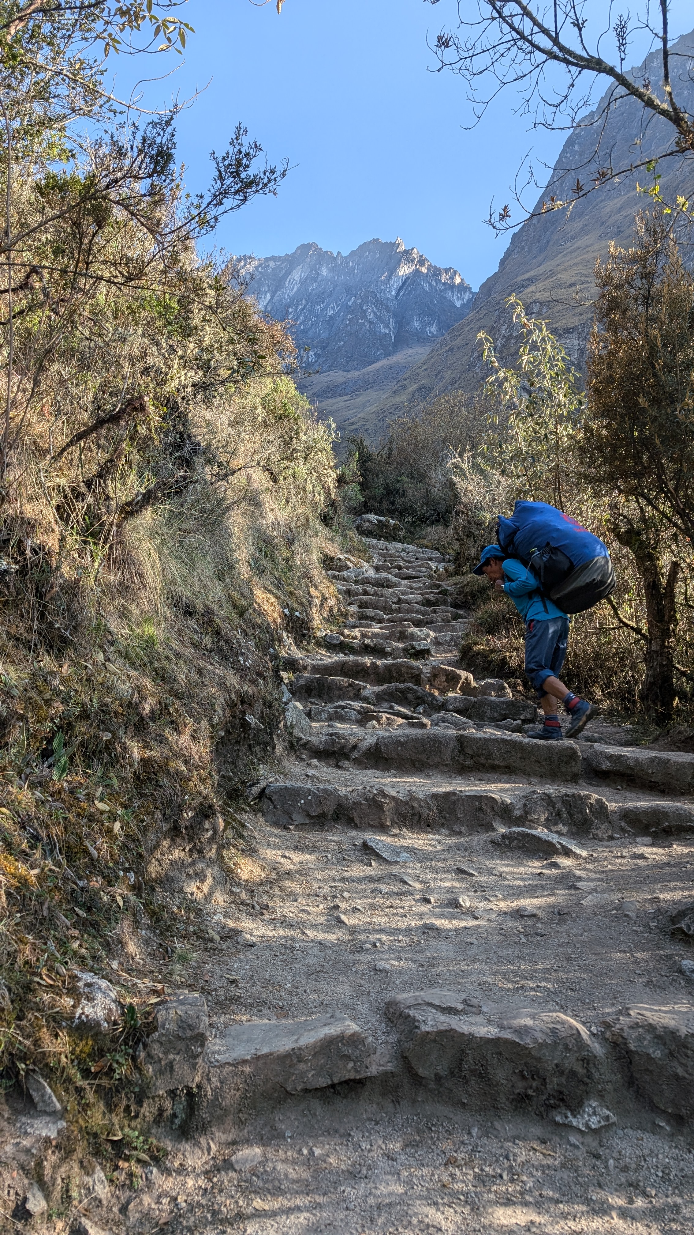 |
| Inca Trail Stairs and a porter. |
As I had predicted prior to the start of the trip, Mom would set out and blaze a trail. I’m more of a slow-to-middle speed hiker, so I let her go. The family of three were also often in the front of the pack, being from Colorado and a bit more used to elevation than the rest of us. That first night it was starting to get dark as we got to camp. In Peru the sunset occurred around 5:45 pm, an early night for sure.
Camp was all set up for us when we got there. Mom and I shared a tent that was rather spacious; even larger than the ones we had on Kilimanjaro. We stuck to the same sides of the tent the whole trip, since we got into a routine of putting our things in the same places. Sleep was a mixed bag. My hands, which were showing signs of a sun-reaction were somewhat painful, and kept me up for a while, before I eventually drifted off to sleep.

Day 2 on the Inca Trail was the one they warned us about. It is a super challenging day with 2 high mountain passes. We started our day at Ayapata Camp at 10,829 ft. We then hiked up, up, up. First we went up to a place that could serve as a campsite, but for us was just a resting place. We rested there for about 20 minutes, waiting for everyone to get to the site and have a chance to rest before the push up to Dead Woman’s Pass. As far as people know, there was no actual “dead woman”, but they say that the shape of the mountain pass as seen from afar looking like a woman laying down. Dead Woman’s Pass is at 13,780 ft, so an exhausting climb of just under 3,000 feet up to the top. While the day before Mom had been in the lead, on Day 2 the altitude definitely hit her and she struggled. I found it less of an issue, whether that is because of my hiking style of slow and steady, or because I had experience with higher altitude climbing and knew the best way to push through it, I’m not sure. I stayed with mom and tried to keep her going to the next rock or place to sit and rest. We’d hike up maybe 50 feet at a time and then take a break for 30-60 seconds, and then every 15 minutes or so take a 2-3 minute break. As we neared the top of Dead Woman’s Pass, she told me to go ahead, that she’d be fine. I pushed forward, taking the occasional break to make sure she was still coming. That day was certainly a tough one. The New York crew had some real troubles with it, having had less acclimation time than we did. They also had smaller water bladders and ran out of water before reaching the pass. I had 4 liters going into the day’s hike and still had roughly 700 mL in my Nalgene and 1.5 L in my backpack, so I gave about 750 mL to one of the New Yorkers so they had more water. We’d be able to get more water once we got to lunch at the bottom of the Pass.
 |
| Heading up to Dead Woman's Pass |
 |
| The crew up at the top of Dead Woman's Pass flashing the alapaca hands. |
After resting for a bit up at the top we started the part I actually dreaded, the downhill part. My knees HATE downhill. And it wasn’t an easy downhill, but had steps of varying sizes and heights. Some steps were maybe 8 inches in height, while others were 30 inches, so you had to be careful and pay attention. Probably about 300 vertical feet down (out of 2000 ft), my right knee started screaming at me, so I pulled out my knee brace. I took it easy because I knew it would be an issue. Downhills are when I fully appreciate my hiking poles which help take some of the force of going downhill off. One unexpectedly painful part of this downhill involved my hands. Since I was a preteen I’ve occasionally had issues where I essentially get an allergic reaction to the sun. When it happens, I’m usually in sunny environments that are not home and closer to the sun. I started experiencing this before we left for the hike, but being on the trail at a higher elevation seemed to have kicked it in high gear. My hands literally felt like they were burning any time they were exposed to sunlight; like I had stuck my hands in a pot of boiling water. It hurt so bad, and I had trouble sleeping too because of the pain. It was at its worst on the way down from Dead Woman’s Pass.
 |
| The way down from Dead Woman's Pass |
Thanks to a steady downhill pace, Mom and I were just the second and third people to arrive at lunch. Our 15 year old, who still has knees that work, practically ran down from the Pass. We had lunch, refilled our water, and then set out for the second Pass of the day, Runkurakay Pass at 13,123 feet. The second pass wasn’t nearly as bad, but we were more tired so that made it not exactly pleasant. We stopped at the Runkurakay ruins on the way up to the Pass and got some more history lessons. From there we could also see Dead Woman’s Pass across the valley, which offered a neat view. After reaching Runkurakay Pass, Mom and I started down the other side. The sun was definitely trending downwards and we wanted to reach camp before it got dark. One thing we weren’t expecting when we hit the other side of the Pass was smoke. I’ve experienced enough wildfire smoke to know what it looks and smells like and we definitely hit smoke and short visibility on the far side of Runkurakay Pass. We were later told that there are places in the area where they do controlled burns before the rainy season starts (October) to clear some of the growth of the forest and that’s what the smoke was.
 |
| Sayamarca with a smokey sunset. |
When we got to camp that evening there were llamas waiting for us…like they were just hanging out in the overall camp area, but not in our campsite. We had more good food and everyone was exhausted and tired. Funny story about the night of Day 2…I had to get up in the middle of the night to go to the bathroom and when I was coming back, blind because I didn’t have my glasses on and only having light from my headlamp, I miscounted tents and opened the wrong tent. I felt like I was in the wrong place before I even fully opened the tent, because the zipper wasn’t in the place I thought I had left it. But once I opened in and went to crawl in, there was a leg where I meant to go! Oops!
 |
| Snack Time! |
Our last full day of hiking was a fairly fun one overall. Moods were a bit lighter since the worst of it was over, and we were just a day away from Machu Picchu. We started out with some uphill Inca Flat, before starting downhill. We had about 3400 feet of downhill to cover before getting to our nighttime campsite, so the knees weren’t going to have a happy day. We made it all of about 15 minutes uphill before we all had to shed our multiple layers of clothes we had on. A little bit further along we were able to see Salkantay, the 2nd highest mountain in Peru. The Salkantay Trail is an alternate way to get to Machu Picchu, and involves passing by Salkantay en route. While we were stopped, Ronaldino also showed us how the Incas would create rope bridges using grass. There is one bridge in the region that is rebuilt every year this way. People on both sides create ropes from grass involving small ropes being woven into larger ropes, being woven into larger ropes, and then they start to work the span across before meeting in the middle.
 |
| Ronaldino making rope from grass. |
As we made our way down, down, down both my knees and Jenny’s knees were not happy and the two of us were a back of the pack slow group. It was nice to get the chance to talk with some of the others, as the New York girls were at the back with us. We made our way to the ruins at Intipata,which were an agriculture center for Machu Picchu and the area back in the Inca days. It was a large site with lots and lots of terraces. A little bit further along, we made our way into camp. It was a short day of hiking because the last day was going to be an early one. After lunch at camp, we headed into WiñayWayna, a set of ruins that was a religious, agriculture, and housing village. I was immensely impressed with WiñayWayna. There we got more history lessons and our Alpaca Expedition t-shirts for the next day at Machu Picchu.
 |
| WinayWayna |
After dinner, we got our tips together for all our crew and presented them to them because that would be the last time we saw most of them because the next morning we get up really early and leave camp, having a sack breakfast instead of one in the mess tent. We got all packed up, and then went to bed, knowing that we had a 3am wake-up call coming.
 |
| Us and our amazing porters and chef! |
The last morning we got up and put together as fast as possible. The reason for the early wakeup call was so we could be as close as possible to the front of the line the next morning where we would have to wait at the gate to be let onto the trail that leads to Machu Picchu. The gate doesn’t open until 5:30am and the further back you are, the more people you’ll have in front of you. We did good. We were up at the front of the line and from there were able to doze for the next 2 hours and eat our sack breakfast. Just as the sun was starting to rise, the gate opened and we set out for Machu Picchu.
 |
| Waiting for the gate to open |
The last day of hiking the trail was Inca Flat and actual flat, and then came the Gringo Killer, a set of maybe 50 short, steep stairs just before reaching the Sun Gate. The Gringo Killer is best climbed in a standard hands and feet scramble. It was actually easier to climb than some of the other sets of stairs we had climbed up and down during the rest of the trip. I have no pictures of the Gringo Killer because I had 180 people hiking behind me and didn’t want to slow down to take a picture of them.
 |
| Mom and I with Machu Picchu in the background, taken at the Sun Gate. |
After making it past the Gringo Killer, a short ways away was the Sun Gate, the first place from which you can see Machu Picchu. The sun shines through the Sun Gate just after sunrise on the winter solstice and hits the main religious temple at Machu Picchu, marking the start of a new year. Up at the Sun Gate we took a bunch of photos and then started our trek down to Machu Picchu.

No comments:
Post a Comment